CRDDS Method of the Month
GIS: Map Design
MOTM GIS Miniseries:
All mini-workshops Tuesdays 12:00 to 12:30 pm
In-Depth Workshops:
Tuesdays 12:00 to 2:00 pm
Nov 13: GIS Day
Outline
- Refresher on Datums/Projections
- Style & Design considerations
- Think about some maps!
- What's next?
REVIEW... putting stuff on a map is more compicated than it seems...
Projection, or how we warp the grid
Mercator Projection
Gall-Peters Projection
.svg)
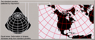

Wikimedia
Projection
Map Design
(aka: Cartography)
Both an Art and a Science!
Start Planning
- What are you trying to communicate?
- Assess your data
- Prioritize the message
- Simplify, simplify, simplify!
Personal Example:
Kwajalein & Marshall Islands
Principles
- Visual Contrast
- Legibility
- Figure-Ground Organization
- Hierarchy
- Compositional Balance
Take a look at Buckley, 2012
Where do I start?
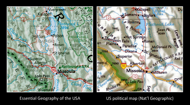
Start by looking at maps!
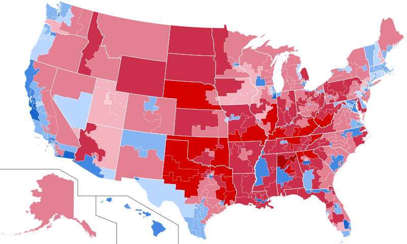
COVID two ways:
A word on color...
Wrap up! What's next?
Have Fun!
Thank you
Upcoming:
Contact:
- Email: philip.white@colorado.edu
- Appointment: bit.ly/phil-appt
- Tutorials: outpw.github.io/tutorials/GISmini