CRDDS Method of the Month
GIS: Data & Data Sources
MOTM GIS Miniseries:
All mini-workshops Tuesdays 12:00 to 12:30 pm
In-Depth Workshops:
Tuesdays 12:00 to 2:00 pm
Nov 13: GIS Day
Outline
- Refresher on Geospatial Data
- Data Finding Strategy
- Go-To Data Sources
Google is your friend!
But Googling can only get you so far if you don't know what to Google...
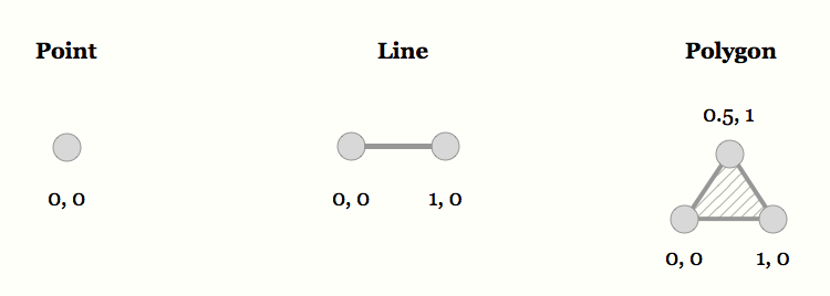
So Let's Recap
5 Things:
- Points
- Lines
- Polygons
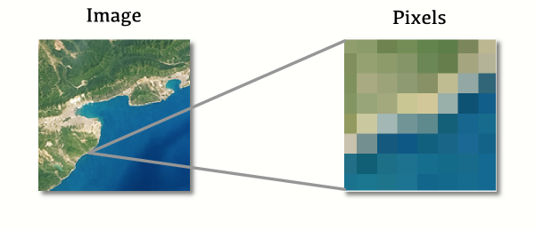
- Pixels/Cells
- And their associated attributes
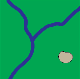
Vector Data
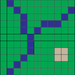
Raster Data
When adding data to a GIS, we often refer to them as "layers."
Common Vector Formats:
- Most often: Shapefile (.shp)
- kml/kmz
- GeoJson
Common Raster Formats:
- Usually GeoTiff
- Also ArcGRID, jpeg2000, others
Spatially enabled databases
(Can store multiple layers/data sets;
both vector & raster data)
- Geodatabase (.gdb) [proprietary]
- GeoPackage (.gpkg) [open source]
Great for managing projects
Webby Formats
- Web Map Service (WMS); basically an image
- Web Feature Service (WFS)
- Tiles
Spatial data can seem like it is both everywhere and nowhere in particular at the same time.
First, ask yourself:
Who Cares?
Who cares enough about this data to:
Collect it
Maintain it
Make it publicly available
Often the answer is government—at all levels
Some considerations...
- What is the end goal?
- Cartography vs Analysis
- What is the scale?
- Local? Global?
- Authority
- Is there good documentation/metadata available?
The data you want may not come in a pretty package...
Go-To Sources
libguides.colorado.edu/geospatialdata
See my YouTube Finding Data Playlist!
Bonus!
"Volunteered Geographic Information"
Open Street Map ...RULES!
See my YouTube video on
extracting OSM data using QGIS
What data are you looking for?
Let me know!
Thank you
Upcoming:
Contact:
- Email: philip.white@colorado.edu
- Appointment: bit.ly/phil-appt
- Tutorials: outpw.github.io/tutorials/GISmini